Trail Mountain bike La Thuile - Bauges - La vallée du Lindar - Photo

Bauges - La vallée du Lindar

 tracegps
tracegps

User

© OpenStreetMap contributors
Length
Length
18 km
Max alt
Max alt
1464 m
Uphill gradient
Uphill gradient
1006 m
Km-Effort
Km-Effort  
31 km
Min alt
Min alt
964 m
Downhill gradient
Downhill gradient
1004 m
Boucle
Boucle
Yes
Creation date :
2014-12-10 00:00:00.0
Updated on :
2014-12-10 00:00:00.0

(1 Reviews)

Mountain bike
Mountain bike
3h00
Difficulty : Difficult

Scan this QR Code to open this trail in the SityTrail application

FREE GPS app for hiking

Logo SityTrail SityTrail

IGN / Geographical institutes

Download SityTrail from the App Store Download SityTrail from Google Play

Logo SityTrail SityTrail World

The world is yours!

Download SityTrail from the App Store Download SityTrail from Google Play Download SityTrail on Huawei AppGallery

About

Trail Mountain bike of 18 km to be discovered at Auvergne-Rhône-Alpes, Savoy, La Thuile. This trail is proposed by tracegps.

Description

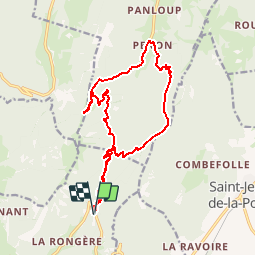
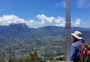
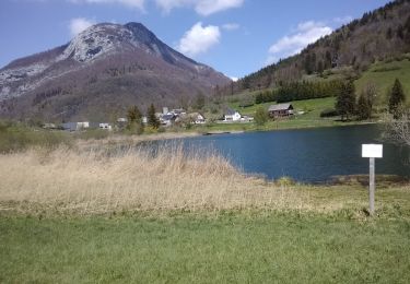
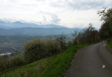
Circuit proposé par Alpes Tour Départ par le col de Marocaz. L’accès se fait en voiture par la D11 accessible depuis Cruet (entre Montmelian et Saint Pierre d'Albigny). Toutes les infos sur ce parcours sont ICI

Elevation profile

Photos

Positioning

Country:
France
Region :
Auvergne-Rhône-Alpes
Department/Province :
Savoy
Municipality :
La Thuile
Location:
Unknown
Start:(UTM)
271769 ; 5048237 (32T) N.

Comments

Please log in to post a review or rate the element


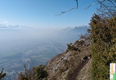
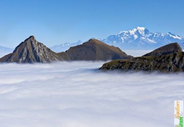
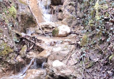
Super variés et de très beau paysage


Trails nearby

Trail Walking Arbin - La Roche du Guet depuis Arbin, Montmélian - Photo
Walking
tracegps

Walking

Medium
(1)
Arbin, Auvergne-Rhône-Alpes, Savoy, France
9.5 km | 21 km-effort
6h 0min
Yes
Trail Walking Saint-Pierre-d'Albigny - La Dent d'Arclusaz, 2041m - Photo
Walking
tracegps

Walking

Difficult
(2)
Saint-Pierre-d'Albigny, Auvergne-Rhône-Alpes, Savoy, France
13.9 km | 29 km-effort
7h 30min
Yes
Trail Walking Aillon-le-Jeune - La Pointe de la Galoppaz 1680m, depuis le Col du Lindar - Photo
Walking
tracegps

Walking

Easy
(1)
Aillon-le-Jeune, Auvergne-Rhône-Alpes, Savoy, France
7.4 km | 14.9 km-effort
3h 45min
No
Trail Snowshoes Thoiry - Bauges Pointe de la Galoppaz  - Photo
Snowshoes
c.gourme

Snowshoes

Medium
(1)
Thoiry, Auvergne-Rhône-Alpes, Savoy, France
9.7 km | 18.7 km-effort
4h 22min
Yes
Trail Walking La Thuile - Crêtes de la Savoyarde - Photo
Walking
GuyVachet

Walking

Difficult
La Thuile, Auvergne-Rhône-Alpes, Savoy, France
10.9 km | 19.9 km-effort
6h 21min
No
Trail Walking La Thuile - roche de Guet et Roc d Tormery - Photo
Walking
nadd73

Walking

Easy
La Thuile, Auvergne-Rhône-Alpes, Savoy, France
10.1 km | 17.6 km-effort
2h 48min
Yes
Trail Mountain bike Arbin - les vignes et la combe de Savoie  - Photo
Mountain bike
boissin-pat

Mountain bike

Medium
(1)
Arbin, Auvergne-Rhône-Alpes, Savoy, France
25 km | 33 km-effort
3h 24min
No
Trail Snowshoes La Thuile - Rocher de manettaz - lac de la thuile - Photo
Snowshoes
24nus

Snowshoes

Very easy
(1)
La Thuile, Auvergne-Rhône-Alpes, Savoy, France
4.5 km | 7 km-effort
2h 21min
Yes
Trail Walking Thoiry - THOIRY-PACHOUD-RIPPE-29-03-24 - Photo
Walking
papou73

Walking

Medium
(1)
Thoiry, Auvergne-Rhône-Alpes, Savoy, France
6.7 km | 10.2 km-effort
2h 45min
Yes


Close
My subscriptions